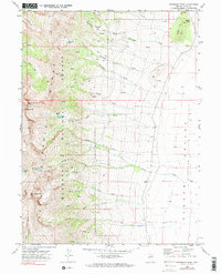
1969 Map of Humboldt Peak
USGS Topo · Published 1990About this map
The East Humboldt Range dominates the western half of this 1969 survey, characterized by dramatic elevation changes that reach their heights at Humboldt Peak and Hole In The Mtn Peak. Within these high alpine basins, several glacial lakes are tucked away, including Winchell Lake, Steele Lake, and Boulder Lake. To the east, the terrain transitions abruptly from the Humboldt National Forest into the Clover Valley, a flat basin where numerous mountain streams like Steele Creek and Weeks Creek descend from the peaks. The infrastructure of the era is defined by a network of Pack Trails and Jeep Trails that provided access to remote springs such as Bradish Spring and the high elevations of Lizzies Basin. Small indicators of early settlement, like a lonely Cem on the valley floor, suggest the localized history of ranching and land use in this Elko County landscape.
Find a feature on this map
33 named features on this map. Tap any name to fly to it.
Don’t see what you’re looking for? This feature index may not catch every label — zoom into the map to look around manually.
Map Details
Editions of this 1969 Humboldt Peak Map
3 editions found
Other maps of this area

1935 · Halleck
USGS Topo · 1:125,000

1955 · Wells
USGS Topo · 1:250,000

1955 · Elko
USGS Topo · 1:250,000

1958 · Wells
USGS Topo · 1:250,000

1958 · Elko
USGS Topo · 1:250,000

1961 · Wells
USGS Topo · 1:250,000

1962 · Elko
USGS Topo · 1:250,000

1965 · Elko
USGS Topo · 1:250,000

1967 · Welcome
USGS Topo · 1:24,000

1967 · Herder Creek
USGS Topo · 1:24,000