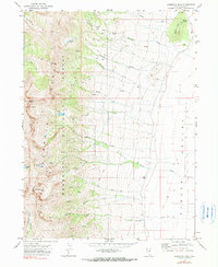
1969 Map of Humboldt Peak
USGS Topo · Published 1990About this map
Humboldt Peak and the high ridges of the Humboldt National Forest dominate this landscape, dropping sharply eastward toward the floor of Clover Valley. The topography is defined by steep canyons carved by numerous waterways like Wiseman Creek, Leach Creek, and Johnson Creek. High-altitude water bodies such as Winchell Lake, Boulder Lake, and Steele Lake sit near the peaks, marking the glacial origins of the basin terrain.
Find a feature on this map
31 named features on this map. Tap any name to fly to it.
Don’t see what you’re looking for? This feature index may not catch every label — zoom into the map to look around manually.
Map Details
Editions of this 1969 Humboldt Peak Map
3 editions found
Other maps of this area

1935 · Halleck
USGS Topo · 1:125,000

1955 · Wells
USGS Topo · 1:250,000

1955 · Elko
USGS Topo · 1:250,000

1958 · Wells
USGS Topo · 1:250,000

1958 · Elko
USGS Topo · 1:250,000

1961 · Wells
USGS Topo · 1:250,000

1962 · Elko
USGS Topo · 1:250,000

1965 · Elko
USGS Topo · 1:250,000

1967 · Welcome
USGS Topo · 1:24,000

1967 · Herder Creek
USGS Topo · 1:24,000