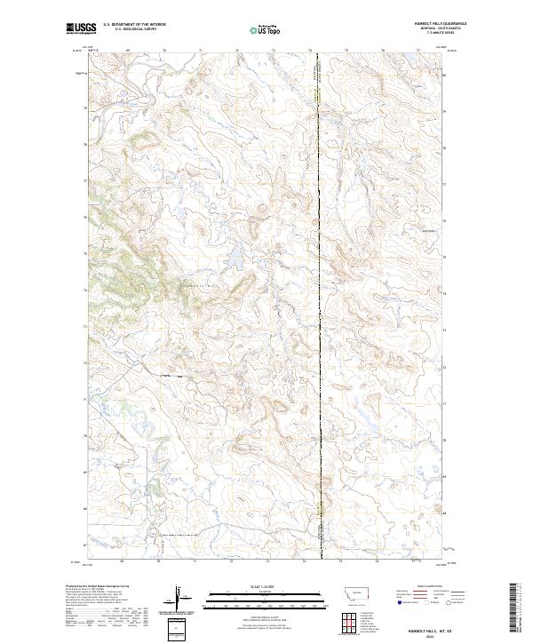
2024 Map of Humbolt Hills
USGS Topo · Published 2024About this map
Humbolt Hills rises as the central topographic landmark along the high plains border of Montana and South Dakota. This modern topographic survey by the U.S. Geological Survey documents the drainage patterns of the region, where Boxelder Creek and Stony Creek carve through the arid terrain of Carter County and Harding County. The map provides a detailed look at the rural infrastructure of the early 21st century, centered on the corridor of Mill Iron Rd. The landscape is characterized by its isolation and the deep incisions of seasonal watercourses like Spring Creek and Seal Draw. The Public Land Survey System grid is clearly defined, showing the section lines of Township 1 North and Township 1 South, which serve as essential references for local land management and genealogical research in this remote corner of the American West.
Find a feature on this map
13 named features on this map. Tap any name to fly to it.
Don’t see what you’re looking for? This feature index may not catch every label — zoom into the map to look around manually.
Map Details
Editions of this 2024 Humbolt Hills Map
This is the sole edition of this map. No revisions or reprints were ever made.
Other maps of this area

1935 · Buffalo
USGS Topo · 1:125,000

1954 · Lemmon
USGS Topo · 1:250,000

1954 · Ekalaka
USGS Topo · 1:250,000

1956 · Ekalaka
USGS Topo · 1:250,000

1957 · Lemmon
USGS Topo · 1:250,000

1958 · Ekalaka
USGS Topo · 1:250,000

1965 · Ekalaka
USGS Topo · 1:250,000

1974 · Caroline Butte
USGS Topo · 1:24,000
1977 · Scott Creek
USGS Topo · 1:24,000
1977 · Doaks Butte
USGS Topo · 1:24,000