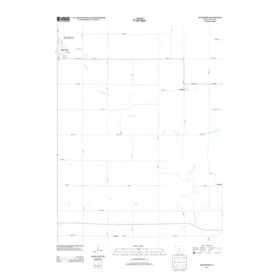
2013 Map of Humeston
USGS Topo · Published 2013About this map
Humeston serves as the primary hub of this agricultural landscape in Wayne County, featuring a traditional grid centered on Broad St and Winter St. The town's historical connection to regional transit is preserved in the Railroad right-of-way Public Hunting Area, which utilizes former rail corridors for conservation. To the east and south, the settlements of Cambria, Saxon, and Peoria anchor a network of rural roads such as Co Hwy-J22 and Liberty Rd. The terrain is defined by the drainage patterns of the S Fork Chariton River and its tributaries, Ninemile Cr and Dick Cr, which meander through a patchwork of farm fields. This survey captures the enduring rural character of southern Iowa, where small crossroads communities remain vital points of reference for local family history and land use.
Find a feature on this map
40 named features on this map. Tap any name to fly to it.
Don’t see what you’re looking for? This feature index may not catch every label — zoom into the map to look around manually.
Map Details
Editions of this 2013 Humeston Map
This is the sole edition of this map. No revisions or reprints were ever made.
Other maps of this area

1934 · Humeston
USGS Topo · 1:48,000

1937 · Corydon
USGS Topo · 1:62,500

1954 · Centerville
USGS Topo · 1:250,000

1957 · Centerville
USGS Topo · 1:250,000

1958 · Centerville
USGS Topo · 1:250,000

1964 · Woodland
USGS Topo · 1:24,000

1964 · Allerton
USGS Topo · 1:24,000

1964 · Clio
USGS Topo · 1:24,000
1965 · Le Roy
USGS Topo · 1:24,000
1965 · Garden Grove
USGS Topo · 1:24,000