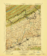
1943 Map of Hummelstown
USGS Topo · Published 1943About this map
Indiantown Gap Military Reservation dominates the center of this wartime landscape, illustrating the rapid expansion of military infrastructure along the flanks of Blue Mountain and Second Mountain. To the south, the planned character of the region is evident in the development around Hummelstown, where the Hershey Zoo and Hershey Hosp appear alongside numerous rural schools like the Hershey Ind Sch. The Reading railroad network serves as a vital artery, connecting remote points such as Rausch Gap Sta and Cold Spring Sta within the narrow valleys between Sharp Mountain and Stony Mountain.
Find a feature on this map
125 named features on this map. Tap any name to fly to it.
Don’t see what you’re looking for? This feature index may not catch every label — zoom into the map to look around manually.
Map Details
Editions of this 1943 Hummelstown Map
This is the sole edition of this map. No revisions or reprints were ever made.
Other maps of this area

1891 · Lebanon
USGS Topo · 1:62,500

1892 · Lykens
USGS Topo · 1:62,500

1892 · Hummelstown
USGS Topo · 1:62,500

1892 · Harrisburg
USGS Topo · 1:62,500

1892 · Pine Grove
USGS Topo · 1:62,500

1893 · Lykens
USGS Topo · 1:62,500

1893 · Lebanon
USGS Topo · 1:62,500

1893 · Millersburg
USGS Topo · 1:62,500

1899 · Lebanon
USGS Topo · 1:62,500

1899 · Harrisburg
USGS Topo · 1:62,500
Featured Places
- Hershey, Derry Township
- Palmyra, PA
- Campbelltown, South Londonderry Township
- Rutherford, Swatara Township
- Annville, PA