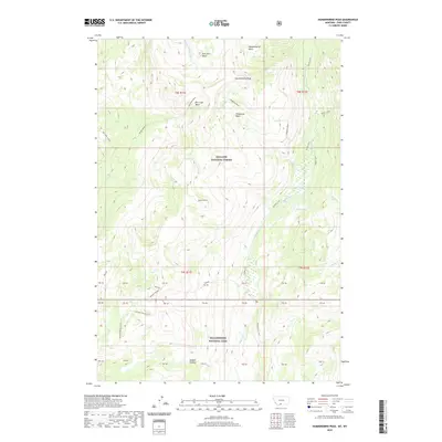
2020 Map of Hummingbird Peak
USGS Topo · Published 2020About this map
Hummingbird Peak rises above a high-elevation alpine landscape within the protected boundaries of the Gallatin National Forest and Yellowstone National Park. This 2020 map documents the complex drainage systems and ridges that separate several high-mountain basins, including East Fork Basin, Hummingbird Basin, and Telephone Basin. The geography is defined by its remoteness, with travel limited to primitive routes such as the Buffalo Plateau Trail, the Elk Creek Cutoff, and the Buffalo Fork Trail. Water sources are abundant across the terrain, with Buffalo Fork and Buffalo Creek carving through the valleys, while Hidden Lake provides a notable landmark east of Buffalo Butte. The map serves as a contemporary record of these high-country wilderness areas, preserving the modern alignment of backcountry trails and hydrologic features like Silver Cr and Grassy Cr as they existed at the turn of the decade.
Find a feature on this map
43 named features on this map. Tap any name to fly to it.
Don’t see what you’re looking for? This feature index may not catch every label — zoom into the map to look around manually.
Map Details
Editions of this 2020 Hummingbird Peak Map
This is the sole edition of this map. No revisions or reprints were ever made.
Other maps of this area

1886 · Canyon
USGS Topo · 1:125,000

1891 · Livingston
USGS Topo · 1:250,000

1893 · Livingston
USGS Topo · 1:250,000

1895 · Canyon
USGS Topo · 1:125,000

1896 · Canyon
USGS Topo · 1:125,000

1901 · Canyon
USGS Topo · 1:125,000

1907 · Canyon
USGS Topo · 1:125,000

1911 · Canyon
USGS Topo · 1:125,000

1940 · Mt Wallace
USGS Topo · 1:62,500

1942 · Cutoff Mtn
USGS Topo · 1:62,500