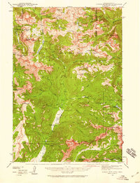
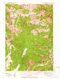
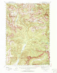
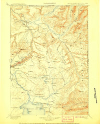
1942 Map of Cutoff Mtn
USGS Topo · Published 1959About this map
The Independence Mine and high-alpine ridges define this remote corner of the Montana-Wyoming border as it appeared during a 1942 survey. Centered on the intersection of the Gallatin National Forest, Custer National Forest, and the northern edge of Yellowstone National Park, the map reveals a landscape managed for both extraction and conservation. Low-lying developments are sparse, represented by the Slough Creek Guard Sta and the Silver Tip Ranch along the waters of Slough Creek. The topography is dominated by massive peaks such as Cutoff Mtn and Mt Abundance, connected by high-altitude passages like Wolverine Pass and Columbine Pass. This survey illustrates the intricate drainage systems that feed the Stillwater River and Boulder River, capturing the wilderness character of the Beartooth and Absaroka ranges before later modern infrastructure.
Find a feature on this map
71 named features on this map. Tap any name to fly to it.
Don’t see what you’re looking for? This feature index may not catch every label — zoom into the map to look around manually.
Map Details
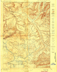
Editions of this 1942 Cutoff Mtn Map
4 editions found

Other maps of this area

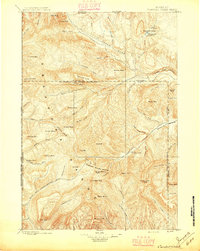
1886 · Canyon
USGS Topo · 1:125,000

1891 · Livingston
USGS Topo · 1:250,000

1893 · Livingston
USGS Topo · 1:250,000

1895 · Canyon
USGS Topo · 1:125,000
1896 · Canyon
USGS Topo · 1:125,000
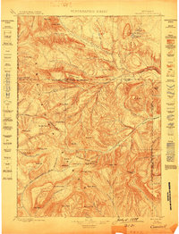
1896 · Crandall Creek
USGS Topo · 1:125,000

1898 · Granite Mountain District
USGS Topo · 1:125,000
1899 · Crandall
USGS Topo · 1:125,000

1901 · Canyon
USGS Topo · 1:125,000
1907 · Canyon
USGS Topo · 1:125,000