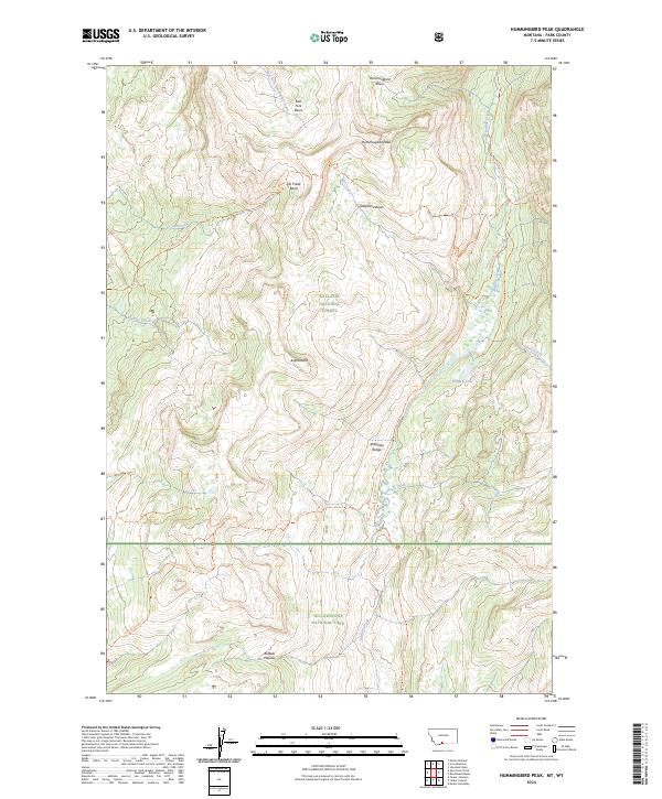
2024 Map of Hummingbird Peak
USGS Topo · Published 2024About this map
Yellowstone National Park and the Gallatin National Forest meet in this high-altitude landscape of the Absaroka Range, where the northern boundary of the park follows the high ridges and plateaus. The topography is dominated by the massive Buffalo Plateau in the south and the Absaroka-Beartooth Wilderness to the north, showcasing a wilderness area defined by drainage basins rather than human settlements. Remote alpine features like Hummingbird Peak and Hidden Lake are connected only by a network of footpaths, including the Buffalo Fork Trl and the Poacher Trl. The map illustrates the convergence of multiple vital watersheds, including Elk Creek, Buffalo Fork, and East Fork Hellroaring Creek, highlighting how the natural terrain dictates the administrative boundaries of these protected federal lands.
Find a feature on this map
46 named features on this map. Tap any name to fly to it.
Don’t see what you’re looking for? This feature index may not catch every label — zoom into the map to look around manually.
Map Details
Editions of this 2024 Hummingbird Peak Map
This is the sole edition of this map. No revisions or reprints were ever made.
Other maps of this area

1886 · Canyon
USGS Topo · 1:125,000

1891 · Livingston
USGS Topo · 1:250,000

1893 · Livingston
USGS Topo · 1:250,000

1895 · Canyon
USGS Topo · 1:125,000

1896 · Canyon
USGS Topo · 1:125,000

1901 · Canyon
USGS Topo · 1:125,000

1907 · Canyon
USGS Topo · 1:125,000

1911 · Canyon
USGS Topo · 1:125,000

1940 · Mt Wallace
USGS Topo · 1:62,500

1942 · Cutoff Mtn
USGS Topo · 1:62,500