
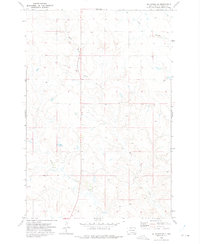
1972 Map of Hump Butte
USGS Topo · Published 1975About this map
The Standing Rock Indian Reservation landscape is documented in this early 1970s survey, straddling the border between North Dakota and South Dakota. The topography is defined by the east-west corridor of the Chicago Milwaukee St Paul and Pacific railroad, which parallels the state line through the southern half of the quadrangle. High ground is marked by Hump Butte in the Prairie View area, while water management for ranching and agriculture is evident through features like Seilers Dam, Watauga Lake, and Mallard Lake. Numerous drainage systems including Timber Creek and Plum Creek carve the prairie, while a Radio Tower and various wells indicate the sparse infrastructure of this rural borderland during the period.
Find a feature on this map
13 named features on this map. Tap any name to fly to it.
Don’t see what you’re looking for? This feature index may not catch every label — zoom into the map to look around manually.
Map Details
Editions of this 1972 Hump Butte Map
This is the sole edition of this map. No revisions or reprints were ever made.
Other maps of this area

1953 · McIntosh
USGS Topo · 1:250,000

1954 · Bismarck
USGS Topo · 1:250,000

1958 · Bismarck
USGS Topo · 1:250,000

1958 · McIntosh
USGS Topo · 1:250,000

1971 · Lookout Butte
USGS Topo · 1:24,000

1971 · Lookout Butte SE
USGS Topo · 1:24,000

1972 · McIntosh SW
USGS Topo · 1:24,000

1972 · Morristown SE
USGS Topo · 1:24,000

1972 · Watauga
USGS Topo · 1:24,000
1972 · McIntosh SE
USGS Topo · 1:24,000