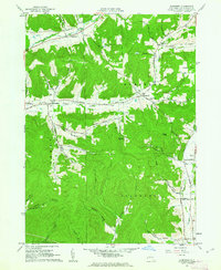
1961 Map of Humphrey
USGS Topo · Published 1963About this map
The town of Humphrey serves as a central hub for this early 1960s survey, surrounded by a complex system of wooded hollows and high ridges in Cattaraugus County. The landscape is marked by a legacy of local extraction and faith, where small clusters of Oil Wells are tucked into the valleys of Pumpkin Hollow and Wrights Creek. These industrial sites neighbor educational and religious landmarks like the Mount Echo Bible Institute and St Pacificus Ch.
Find a feature on this map
56 named features on this map. Tap any name to fly to it.
Don’t see what you’re looking for? This feature index may not catch every label — zoom into the map to look around manually.
Map Details
Editions of this 1961 Humphrey Map
4 editions found
Other maps of this area

1898 · Olean
USGS Topo · 1:62,500

1900 · Salamanca
USGS Topo · 1:62,500

1924 · Ellicottville
USGS Topo · 1:62,500

1924 · Franklinville
USGS Topo · 1:62,500

1938 · Salamanca
USGS Topo · 1:62,500

1938 · Olean
USGS Topo · 1:62,500

1941 · Ellicottville
USGS Topo · 1:62,500

1942 · Franklinville
USGS Topo · 1:62,500

1943 · Olean
USGS Topo · 1:62,500

1943 · Salamanca
USGS Topo · 1:62,500