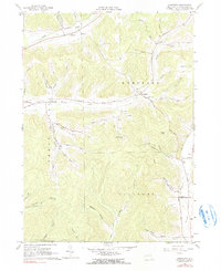
1961 Map of Humphrey
USGS Topo · Published 1990About this map
Humphrey and the surrounding township in Cattaraugus County are defined by a network of steep hollows and narrow creek valleys during the early 1960s. The settlement pattern follows the drainage of Sugartown Creek and Fivemile Creek, where small clusters like Sugartown and Humphrey Center served as local hubs. A distinctive rural institution, the Mount Echo Bible Institute, is situated near Pumpkin Hollow, reflecting the community's cultural landscape.
Find a feature on this map
52 named features on this map. Tap any name to fly to it.
Don’t see what you’re looking for? This feature index may not catch every label — zoom into the map to look around manually.
Map Details
Editions of this 1961 Humphrey Map
4 editions found
Other maps of this area

1898 · Olean
USGS Topo · 1:62,500

1900 · Salamanca
USGS Topo · 1:62,500

1924 · Ellicottville
USGS Topo · 1:62,500

1924 · Franklinville
USGS Topo · 1:62,500

1938 · Salamanca
USGS Topo · 1:62,500

1938 · Olean
USGS Topo · 1:62,500

1941 · Ellicottville
USGS Topo · 1:62,500

1942 · Franklinville
USGS Topo · 1:62,500

1943 · Olean
USGS Topo · 1:62,500

1943 · Salamanca
USGS Topo · 1:62,500