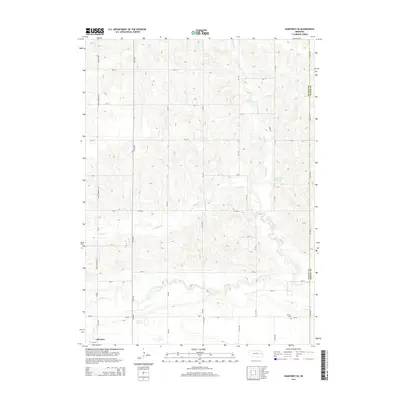
2014 Map of Humphrey SE
USGS Topo · Published 2014About this map
Shell Cr meanders across this rural section of the Nebraska plains, creating a distinct riparian corridor through the agricultural grid of northern Platte County. The landscape is defined by the intersection of numerous county roads and avenues, with Prime Meridian Rd running north-south along the western edge. In the southeast corner of the map, Calvary Cem sits just south of 280 St, providing a primary point of interest for genealogists tracing local families in this farming community. The small settlement of Lakeview is situated in the southwest, while the Loseke-Frese Reservoir and its namesake Loseke Cr occupy the eastern portion of the sheet. Other waterways including Schaad Cr carve gentle valleys through the section lines, illustrating the natural drainage patterns that have historically shaped land use in this part of the state.
Find a feature on this map
32 named features on this map. Tap any name to fly to it.
Don’t see what you’re looking for? This feature index may not catch every label — zoom into the map to look around manually.
Map Details
Editions of this 2014 Humphrey SE Map
This is the sole edition of this map. No revisions or reprints were ever made.
Other maps of this area

1899 · David City
USGS Topo · 1:125,000

1955 · Fremont
USGS Topo · 1:250,000

1957 · Fremont
USGS Topo · 1:250,000

1958 · Fremont
USGS Topo · 1:250,000

1958 · Duncan
USGS Topo · 1:24,000

1958 · Columbus
USGS Topo · 1:24,000

1966 · Clarkson SW
USGS Topo · 1:24,000

1966 · Platte Center
USGS Topo · 1:24,000

1966 · Humphrey SE
USGS Topo · 1:24,000

1966 · Creston
USGS Topo · 1:24,000