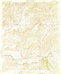
1932 Map of Humphreys
USGS Topo · Published 1932About this map
The Santa Clara River corridor defines this landscape north of Los Angeles, where early 1930s infrastructure began to weave through the canyons of the Angeles National Forest. Small clusters of development at Honby, Solamint, and Humphreys represent the primary points of settlement, often centered around essential community institutions like Honby Sch and Sulphur Spring Sch. The transport network is anchored by the Southern Pacific railroad and the Sierra Highway, which cuts a path toward the high desert.
Find a feature on this map
18 named features on this map. Tap any name to fly to it.
Don’t see what you’re looking for? This feature index may not catch every label — zoom into the map to look around manually.
Map Details
Editions of this 1932 Humphreys Map
3 editions found
Other maps of this area

1900 · Fernando
USGS Topo · 1:62,500

1901 · Southern California Sheet No. 1
USGS Topo · 1:250,000

1903 · Tejon
USGS Topo · 1:125,000

1903 · Camulos
USGS Topo · 1:125,000

1903 · Santa Susana
USGS Topo · 1:62,500

1904 · Southern California Sheet No. 1
USGS Topo · 1:250,000

1915 · Elizabeth Lake
USGS Topo · 1:125,000

1917 · Elizabeth Lake
USGS Topo · 1:125,000

1925 · Sylmar
USGS Topo · 1:24,000

1928 · Sylmar
USGS Topo · 1:24,000