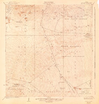
1930 Map of Humuula
USGS Topo · Published 1943About this map
Volcanic activity and high-altitude ranching dominate this 1920s survey of the Big Island's saddle region. The map documents the sprawling Lava Flow of 1843, Lava Flow of 1855, and several later nineteenth-century eruptions that carved distinct paths through the Hilo Forest Reserve and Upper Waiakea Forest Reserve. Isolated outposts like the Humuula Sheep Station and Puu Oo Ranch highlight the livestock industry's footprint on the slopes of the peaks.
Find a feature on this map
48 named features on this map. Tap any name to fly to it.
Don’t see what you’re looking for? This feature index may not catch every label — zoom into the map to look around manually.
Map Details
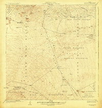
Editions of this 1930 Humuula Map
3 editions found
Other maps of this area

1915 · Honomu
USGS Topo · 1:62,500

1917 · Hilo
USGS Topo · 1:62,500

1921 · Kilauea
USGS Topo · 1:62,500

1922 · Puna
USGS Topo · 1:62,500

1924 · Kilauea
USGS Topo · 1:62,500

1924 · Puna
USGS Topo · 1:62,500

1927 · Kaohe
USGS Topo · 1:62,500

1928 · Mauna Loa
USGS Topo · 1:62,500

1930 · Humuula
USGS Topo · 1:62,500

1930 · Kaohe
USGS Topo · 1:62,500