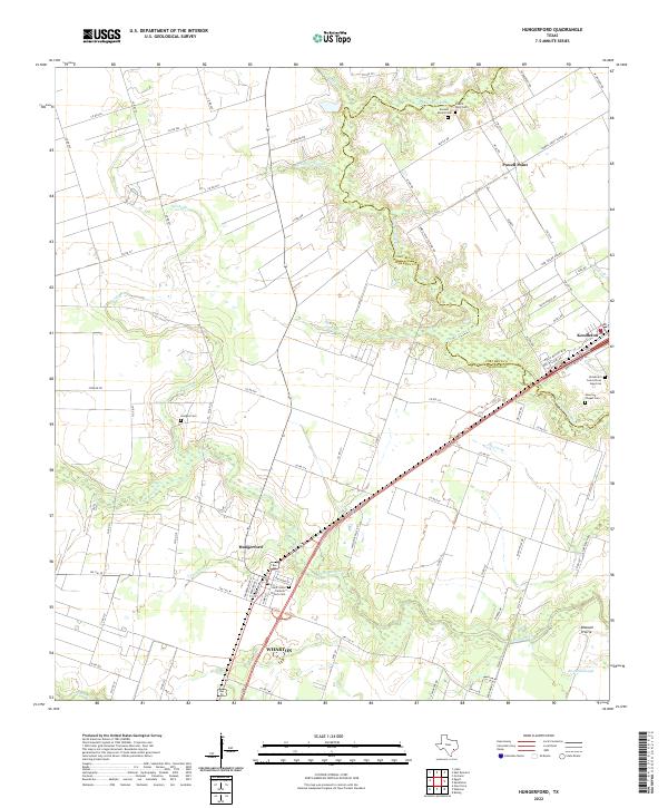
2022 Map of Hungerford
USGS Topo · Published 2022About this map
Hungerford and the surrounding coastal prairie landscape are defined by the meandering course of the San Bernard River, which serves as the boundary between Fort Bend and Wharton counties. This modern topograhic record reveals a corridor of historical significance, particularly evident in the cluster of burial sites such as the Kendleton Cem African American and the Burnett Estate Cem.
Find a feature on this map
86 named features on this map. Tap any name to fly to it.
Don’t see what you’re looking for? This feature index may not catch every label — zoom into the map to look around manually.
Map Details
Editions of this 2022 Hungerford Map
This is the sole edition of this map. No revisions or reprints were ever made.
Other maps of this area

1950 · Houston
USGS Topo · 1:250,000

1952 · Egypt
USGS Topo · 1:24,000

1953 · Kendleton
USGS Topo · 1:24,000

1953 · Wharton
USGS Topo · 1:24,000

1953 · Hungerford
USGS Topo · 1:24,000

1953 · Glen Flora
USGS Topo · 1:24,000

1953 · Boling
USGS Topo · 1:24,000

1953 · Seguin
USGS Topo · 1:250,000

1955 · Richmond
USGS Topo · 1:62,500

1956 · Wallis
USGS Topo · 1:62,500