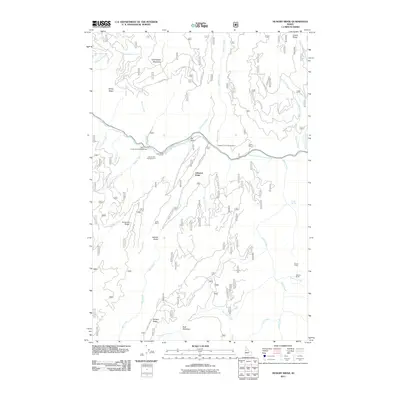
2011 Map of Hungry Ridge
USGS Topo · Published 2011About this map
The South Fork Clearwater River carves a deep valley through this Idaho County landscape, serving as the primary corridor for travel and recreation. Along its banks, the Castle Creek Campground, South Fork Campground, and Meadow Creek Campground mark established points for wilderness access. The surrounding heights are defined by prominent landforms such as Hungry Ridge and Tamarack Ridge, while the presence of the Fisher Mine near Fisher indicates the region's historic ties to resource extraction.
Find a feature on this map
51 named features on this map. Tap any name to fly to it.
Don’t see what you’re looking for? This feature index may not catch every label — zoom into the map to look around manually.
Map Details
Editions of this 2011 Hungry Ridge Map
This is the sole edition of this map. No revisions or reprints were ever made.
Other maps of this area

1931 · Buffalo Hump
USGS Topo · 1:125,000

1934 · Buffalo Hump
USGS Topo · 1:125,000

1955 · Grangeville
USGS Topo · 1:250,000

1956 · Elk City
USGS Topo · 1:250,000

1959 · Grangeville
USGS Topo · 1:250,000

1960 · Elk City
USGS Topo · 1:250,000

1963 · Sourdough Peak
USGS Topo · 1:24,000

1963 · Goodwin Meadows
USGS Topo · 1:24,000

1963 · Huddleson Bluff
USGS Topo · 1:24,000
1963 · Hungry Ridge
USGS Topo · 1:24,000