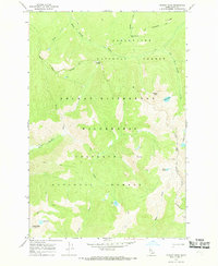
1966 Map of Hungry Rock
USGS Topo · Published 1969About this map
Bailey Mtn Lookout Tower stands as a focal point in the southwestern corner of this high-elevation landscape, where the Selway-Bitterroot Wilderness converges with the Nezperce National Forest and Clearwater National Forest. The map documents a primitive transportation network consisting of several segments of Pack Trail that navigate the ridges and drainages. Notable topographic markers include the namesake Hungry Rock and the evocatively named Army Mule Saddle located near the northern forest boundary. The hydrology is defined by steep descents into drainages like Isaac Creek and Warm Springs Creek, with several small alpine basins holding bodies of water such as Isaac Lake, May Lake, and Hungry Lake. The presence of the lookout tower and the reliance on pack trails suggests a mid-century management period focused on fire surveillance and wilderness preservation.
Find a feature on this map
26 named features on this map. Tap any name to fly to it.
Don’t see what you’re looking for? This feature index may not catch every label — zoom into the map to look around manually.
Map Details
Editions of this 1966 Hungry Rock Map
2 editions found
Other maps of this area

1911 · Lolo
USGS Topo · 1:250,000

1913 · Lolo
USGS Topo · 1:250,000

1956 · Hamilton
USGS Topo · 1:250,000

1959 · Hamilton
USGS Topo · 1:250,000

1960 · Hamilton
USGS Topo · 1:250,000

1964 · Hamilton
USGS Topo · 1:250,000

1966 · Mc Connell Mtn
USGS Topo · 1:24,000

1966 · Grave Peak
USGS Topo · 1:24,000
1966 · Wahoo Peak
USGS Topo · 1:24,000
1966 · Freeman Peak
USGS Topo · 1:24,000