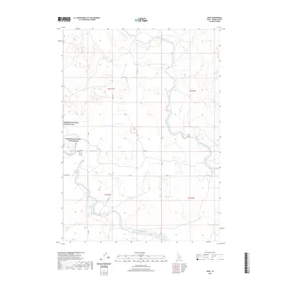
2020 Map of Hunt
USGS Topo · Published 2020About this map
Minidoka National Historic Site defines the western landscape of this Jerome County survey, marking the location of the former relocation center during World War II. The terrain is characterized by the complex irrigation infrastructure essential to southern Idaho's agriculture, with the large Milner Gooding Canal winding through the northern and eastern sections and the North Side Main Canal cutting across the south. A network of secondary water features like Lateral 21 supports the surrounding farmland. The rural road system follows the rigid section lines of the Public Land Survey System, including named routes such as Hunt Rd, S Eden Rd, and E Perrine Rd, which provide access to the dispersed homesteads and agricultural plots of the High Desert region.
Find a feature on this map
22 named features on this map. Tap any name to fly to it.
Don’t see what you’re looking for? This feature index may not catch every label — zoom into the map to look around manually.
Map Details
Editions of this 2020 Hunt Map
This is the sole edition of this map. No revisions or reprints were ever made.
Other maps of this area

1955 · Twin Falls
USGS Topo · 1:250,000

1958 · Twin Falls
USGS Topo · 1:250,000

1964 · Kimberly
USGS Topo · 1:24,000

1964 · Eden
USGS Topo · 1:24,000

1964 · Milner
USGS Topo · 1:24,000

1964 · Hazelton NE
USGS Topo · 1:24,000

1964 · Perrine
USGS Topo · 1:24,000

1964 · Hunt
USGS Topo · 1:24,000
1965 · Milner
USGS Topo · 1:24,000

1971 · Shoshone SE
USGS Topo · 1:24,000