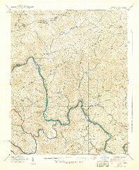
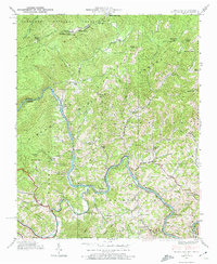
1939 Map of Huntdale
USGS Topo · Published 1939About this map
The Nolichucky River carves a deep, winding path through the borderlands of North Carolina and Tennessee, serving as a corridor for the Clinchfield Railroad during the late 1930s. This survey, conducted by the Tennessee Valley Authority, highlights a landscape of isolated mountain communities connected by the rails and the river. Settlements like Huntdale and Relief are primary hubs, while the high ridges of the Pisgah National Forest and Cherokee National Forest flank the valley.
Find a feature on this map
76 named features on this map. Tap any name to fly to it.
Don’t see what you’re looking for? This feature index may not catch every label — zoom into the map to look around manually.
Map Details
Editions of this 1939 Huntdale Map
5 editions found
Other maps of this area

1891 · Roan Mountain
USGS Topo · 1:125,000

1894 · Roan Mountain
USGS Topo · 1:125,000

1900 · Mount Mitchell
USGS Topo · 1:125,000

1902 · Mount Mitchell
USGS Topo · 1:125,000

1904 · Roan Mountain
USGS Topo · 1:125,000

1934 · Micaville
USGS Topo · 1:24,000

1934 · Bakersville
USGS Topo · 1:24,000

1934 · Iron Mtn Gap
USGS Topo · 1:24,000

1935 · Chestoa
USGS Topo · 1:24,000

1935 · Burnsville
USGS Topo · 1:24,000