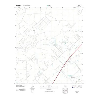
2010 Map of Hunter
USGS Topo · Published 2010About this map
York Creek and its many tributaries, including Caney Creek and Water Hole Creek, define the drainage of this central Texas landscape south of the Guadalupe River. The settlement pattern centers on the community of Hunter, where the local terrain is punctuated by significant elevations like Nail Hill and Coal Kiln Hill. For genealogists and local historians, several family-named burial sites are documented across the quadrangle, including the Rosenthal Cemetery, Conrads Cemetery, Kellerman Cemetery, and York Creek Cemetery.
Find a feature on this map
65 named features on this map. Tap any name to fly to it.
Don’t see what you’re looking for? This feature index may not catch every label — zoom into the map to look around manually.
Map Details
Editions of this 2010 Hunter Map
This is the sole edition of this map. No revisions or reprints were ever made.
Other maps of this area

1911 · San Marcos
USGS Topo · 1:125,000

1919 · San Marcos
USGS Topo · 1:125,000

1925 · New Braunfels No 1
USGS Topo · 1:48,000

1925 · Hunter No 3
USGS Topo · 1:48,000

1927 · New Braunfels
USGS Topo · 1:62,500

1929 · Hunter
USGS Topo · 1:62,500

1930 · Seguin
USGS Topo · 1:62,500

1953 · Seguin
USGS Topo · 1:250,000

1954 · San Antonio
USGS Topo · 1:250,000

1957 · San Antonio
USGS Topo · 1:250,000