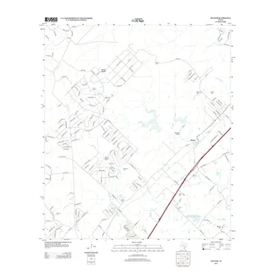
2013 Map of Hunter
USGS Topo · Published 2013About this map
Hunter sits at the intersection of modern transportation and early Texas ranching history, bisected by the heavy transit corridor of Ih 35. This landscape in the early twenty-first century reveals a transition from traditional rural properties like Wegner Ranch and Circle Dot Ranch to residential developments such as Royal Forest. The terrain is marked by distinctive elevations including Coal Kiln Hill and Trunk Hill, while the drainage of York Cr and Alligator Cr defines the local topography. For genealogists and local historians, the presence of several established burial sites, such as Rosenthal Cem and Kellerman Cem, provides critical points of reference for the families who settled this area of Comal and Hays counties. Water management is a visible priority here, evidenced by the Soil Conservation Service Site 3 Reservoir and scattered features like Haley Tank, which support the region's agricultural legacy amidst growing suburban infrastructure.
Find a feature on this map
167 named features on this map. Tap any name to fly to it.
Don’t see what you’re looking for? This feature index may not catch every label — zoom into the map to look around manually.
Map Details
Editions of this 2013 Hunter Map
This is the sole edition of this map. No revisions or reprints were ever made.
Other maps of this area

1911 · San Marcos
USGS Topo · 1:125,000

1919 · San Marcos
USGS Topo · 1:125,000

1925 · New Braunfels No 1
USGS Topo · 1:48,000

1925 · Hunter No 3
USGS Topo · 1:48,000

1927 · New Braunfels
USGS Topo · 1:62,500

1929 · Hunter
USGS Topo · 1:62,500

1930 · Seguin
USGS Topo · 1:62,500

1953 · Seguin
USGS Topo · 1:250,000

1954 · San Antonio
USGS Topo · 1:250,000

1957 · San Antonio
USGS Topo · 1:250,000