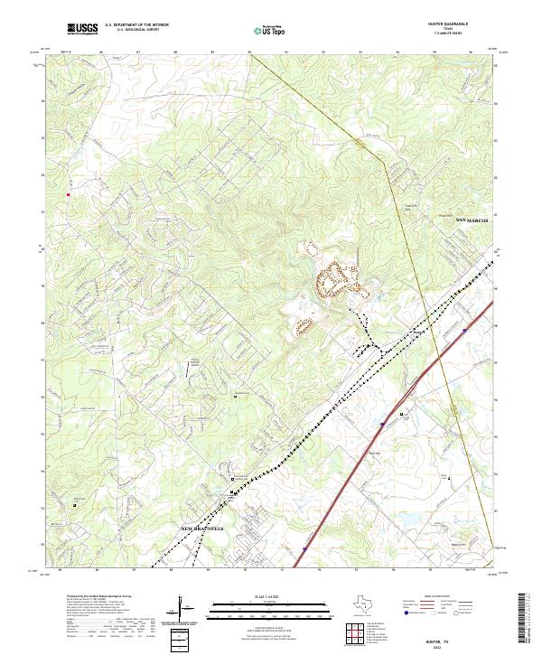
2022 Map of Hunter
USGS Topo · Published 2022About this map
Hunter serves as the focal point for this region along the Hays and Comal county line, where the landscape transitions from the edge of the Texas Hill Country toward the Blackland Prairie. The settlement patterns here are defined by long-standing agricultural roots, evidenced by numerous family and community burial grounds such as York Creek Cem and the dual sites of Conrads Cem Number One and Conrads Cem Number Two.
Find a feature on this map
153 named features on this map. Tap any name to fly to it.
Don’t see what you’re looking for? This feature index may not catch every label — zoom into the map to look around manually.
Map Details
Editions of this 2022 Hunter Map
This is the sole edition of this map. No revisions or reprints were ever made.
Other maps of this area

1911 · San Marcos
USGS Topo · 1:125,000

1919 · San Marcos
USGS Topo · 1:125,000

1925 · New Braunfels No 1
USGS Topo · 1:48,000

1925 · Hunter No 3
USGS Topo · 1:48,000

1927 · New Braunfels
USGS Topo · 1:62,500

1929 · Hunter
USGS Topo · 1:62,500

1930 · Seguin
USGS Topo · 1:62,500

1953 · Seguin
USGS Topo · 1:250,000

1954 · San Antonio
USGS Topo · 1:250,000

1957 · San Antonio
USGS Topo · 1:250,000