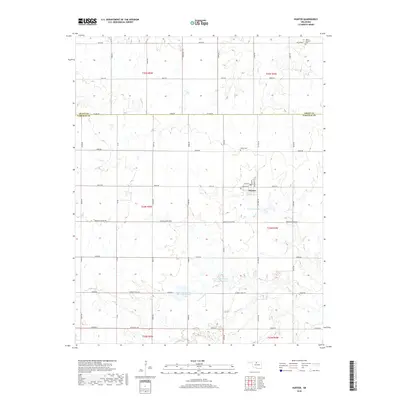
2018 Map of Hunter
USGS Topo · Published 2018About this map
Hunter stands as the primary hub of this North Central Oklahoma landscape, situated at the intersection of Missouri St, Cherokee St, and Main St. The surrounding agricultural terrain is precisely partitioned by an extensive section-line road network, including the Grant Co Garfield Co line and Kremlin-Hunter Rd. For genealogists and local historians, the placement of Mount Pleasant Cem in the northeast and White Cem north of town provides specific points of interest for family research. Water management is a defining characteristic of the modern era, evidenced by the presence of Upper Red Rock Cr Site 24 Reservoir and Upper Red Rock Cr Site 25 Reservoir along the drainage of Red Rock Cr. This survey illustrates the persistent importance of small-town centers and managed water resources in Oklahoma's rural prairie lands.
Find a feature on this map
40 named features on this map. Tap any name to fly to it.
Don’t see what you’re looking for? This feature index may not catch every label — zoom into the map to look around manually.
Map Details
Editions of this 2018 Hunter Map
This is the sole edition of this map. No revisions or reprints were ever made.
Other maps of this area

1955 · Enid East
USGS Topo · 1:24,000

1955 · Enid
USGS Topo · 1:250,000

1956 · Garber
USGS Topo · 1:62,500

1956 · Enid
USGS Topo · 1:62,500

1958 · Enid
USGS Topo · 1:250,000

1968 · Lamont SE
USGS Topo · 1:24,000

1968 · Lamont NW
USGS Topo · 1:24,000

1968 · Hunter
USGS Topo · 1:24,000

1968 · Kremlin
USGS Topo · 1:24,000

1968 · Lamont
USGS Topo · 1:24,000