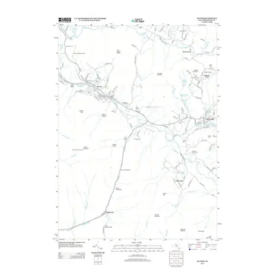
2013 Map of Hunter
USGS Topo · Published 2013About this map
Hunter and Tannersville serve as the primary mountain hubs in this northern Catskills region, where the headwaters of Schoharie Cr flow through a valley defined by high peaks. The landscape is a mix of tight-knit residential clusters and expansive recreational terrain, featuring notable camps like Camp Beecher and Camp Mayfair. Local heritage is preserved in scattered burial grounds such as the Mill Family Cem and Saint Mary's of the Mtn Cem, which reflect the area's long-standing settlement history. To the south, the dramatic pass of Stony Clove Notch and the landmark Devils Tombstone highlight the steep geography that restricted early travel. The map also records the critical infrastructure of the era, from the Hunter Mountain Fire Tower perched atop its namesake peak to the series of Tannersville Reservoirs providing water to the downslope communities.
Find a feature on this map
149 named features on this map. Tap any name to fly to it.
Don’t see what you’re looking for? This feature index may not catch every label — zoom into the map to look around manually.
Map Details
Editions of this 2013 Hunter Map
This is the sole edition of this map. No revisions or reprints were ever made.
Other maps of this area

1892 · Kaaterskill
USGS Topo · 1:62,500

1893 · Kaaterskill
USGS Topo · 1:62,500

1893 · Durham
USGS Topo · 1:62,500

1894 · Kaaterskill
USGS Topo · 1:62,500

1894 · Durham
USGS Topo · 1:62,500

1899 · Kaaterskill
USGS Topo · 1:62,500

1900 · Phoenicia
USGS Topo · 1:62,500

1901 · Gilboa
USGS Topo · 1:62,500

1903 · Gilboa
USGS Topo · 1:62,500

1903 · Phoenicia
USGS Topo · 1:62,500