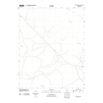
2010 Map of Hunter Mesa
USGS Topo · Published 2010About this map
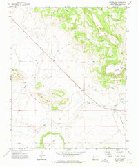
The Hunter Mesa landscape of northeastern New Mexico is defined by a series of high, flat-topped landforms separated by seasonal drainage networks. Notable features include Juan Torres Mesa and Dwyer Mesa, which overlook the winding course of Una de Gato Creek as it moves through the southern half of the quadrangle. The area is characterized by a sparse, ranch-oriented settlement pattern, with the T-O Ranch serving as a significant local landmark in the eastern portion of the sheet. Modern transportation routes, including the joint highway corridor of 64 87, cross the terrain, linking the cattle country to the broader region. Numerous arroyos, such as Black Mesa Arroyo and Green Mountain Arroyo, illustrate the hydraulic complexity of this arid environment, showing how water has sculpted the margins of Black Mesa over generations.
Find a feature on this map
12 named features on this map. Tap any name to fly to it.
Don’t see what you’re looking for? This feature index may not catch every label — zoom into the map to look around manually.
Map Details
Editions of this 2010 Hunter Mesa Map
This is the sole edition of this map. No revisions or reprints were ever made.
Other maps of this area

1912 · Raton
USGS Topo · 1:62,500

1914 · Raton
USGS Topo · 1:62,500

1954 · Raton
USGS Topo · 1:250,000

1958 · Raton
USGS Topo · 1:250,000

1971 · Clifton House
USGS Topo · 1:24,000
1971 · Raton
USGS Topo · 1:24,000
1971 · Dale Mountain
USGS Topo · 1:24,000
1971 · Eagle Tail Mountain
USGS Topo · 1:24,000
1971 · Hunter Mesa
USGS Topo · 1:24,000

1971 · Johnson Park
USGS Topo · 1:24,000