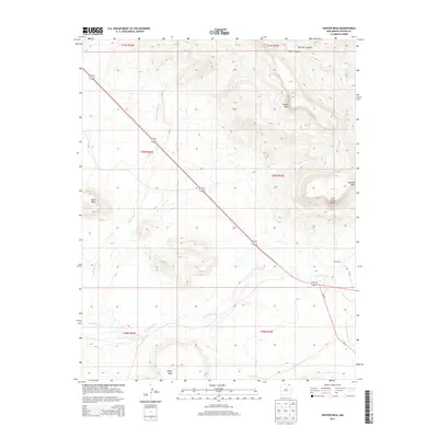
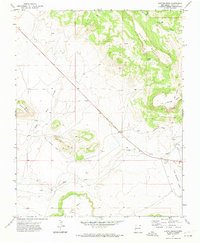
2013 Map of Hunter Mesa
USGS Topo · Published 2013About this map
Hunter Mesa and Black Mesa dominate this high-plains landscape in Colfax County, where the topography is defined by a series of prominent, flat-topped landforms. This early 21st-century survey reveals a territory of vast mesas and deep drainages, including Juan Torres Mesa and Meloche Mesa to the east. The drainage network is particularly detailed, tracing the paths of Una de Gato Cr and its tributaries like Little Water Cr as they cut through the arid terrain. Human presence is sparse, centered primarily on the T O Ranch and the diagonal route of highway 64 87. Genealogists and local historians can use the map to identify specific family-named landmarks such as Dwyer Mesa or trace the water sources vital to ranching life, including Salazar Spring and the complex system of arroyos like Green Mountain Arroyo that drain the mesas.
Find a feature on this map
23 named features on this map. Tap any name to fly to it.
Don’t see what you’re looking for? This feature index may not catch every label — zoom into the map to look around manually.
Map Details
Editions of this 2013 Hunter Mesa Map
This is the sole edition of this map. No revisions or reprints were ever made.
Other maps of this area

1912 · Raton
USGS Topo · 1:62,500

1914 · Raton
USGS Topo · 1:62,500

1954 · Raton
USGS Topo · 1:250,000

1958 · Raton
USGS Topo · 1:250,000

1971 · Clifton House
USGS Topo · 1:24,000
1971 · Raton
USGS Topo · 1:24,000
1971 · Dale Mountain
USGS Topo · 1:24,000
1971 · Eagle Tail Mountain
USGS Topo · 1:24,000
1971 · Hunter Mesa
USGS Topo · 1:24,000

1971 · Johnson Park
USGS Topo · 1:24,000