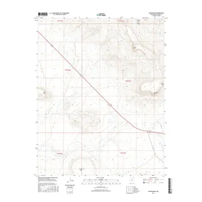
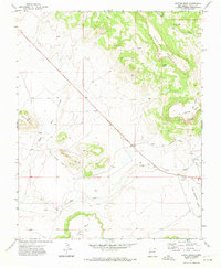
2017 Map of Hunter Mesa
USGS Topo · Published 2017About this map
Hunter Mesa and its surrounding tablelands dominate this Colfax County landscape, where elevation changes are defined by prominent landforms like Black Mesa and Meloche Mesa. The terrain is deeply incised by drainages such as Burchet Canyon and Miller Canyon, which channel seasonal water toward the lower plains. These canyons and mesas dictate the path of transportation, most notably the combined route of Highway 64 and 87 as it cuts diagonally across the township lines of the t30n r25e and t30n r24e survey sections.
Find a feature on this map
21 named features on this map. Tap any name to fly to it.
Don’t see what you’re looking for? This feature index may not catch every label — zoom into the map to look around manually.
Map Details
Editions of this 2017 Hunter Mesa Map
This is the sole edition of this map. No revisions or reprints were ever made.
Other maps of this area

1912 · Raton
USGS Topo · 1:62,500

1914 · Raton
USGS Topo · 1:62,500

1954 · Raton
USGS Topo · 1:250,000

1958 · Raton
USGS Topo · 1:250,000

1971 · Clifton House
USGS Topo · 1:24,000
1971 · Raton
USGS Topo · 1:24,000
1971 · Dale Mountain
USGS Topo · 1:24,000
1971 · Eagle Tail Mountain
USGS Topo · 1:24,000
1971 · Hunter Mesa
USGS Topo · 1:24,000

1971 · Johnson Park
USGS Topo · 1:24,000