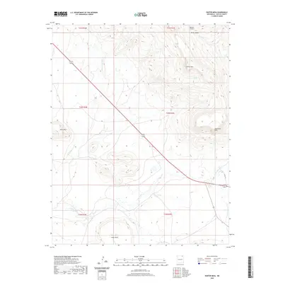
2020 Map of Hunter Mesa
USGS Topo · Published 2020About this map
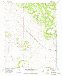
Hunter Mesa and Juan Torres Mesa dominate this high-plains landscape in northeastern New Mexico, where the terrain is defined by dramatic elevations and seasonal watercourses. The drainage patterns of the region are clearly visible through the winding Black Mesa Arroyo and the network of Una de Gato Cr and its tributary, Little Water Cr. This 2020 U.S. Geological Survey data illustrates the arid geography of the Raton area, where cattle ranching and land management are shaped by the availability of water at features like Salazar Spring. The diagonal path of US Highway 64 87 serves as the primary artery through this section of Colfax County, cutting across the township and range lines that divide the mesa-studded horizon near Dwyer Mesa and Black Mesa.
Find a feature on this map
20 named features on this map. Tap any name to fly to it.
Don’t see what you’re looking for? This feature index may not catch every label — zoom into the map to look around manually.
Map Details
Editions of this 2020 Hunter Mesa Map
This is the sole edition of this map. No revisions or reprints were ever made.
Other maps of this area

1912 · Raton
USGS Topo · 1:62,500

1914 · Raton
USGS Topo · 1:62,500

1954 · Raton
USGS Topo · 1:250,000

1958 · Raton
USGS Topo · 1:250,000

1971 · Clifton House
USGS Topo · 1:24,000
1971 · Raton
USGS Topo · 1:24,000
1971 · Dale Mountain
USGS Topo · 1:24,000
1971 · Eagle Tail Mountain
USGS Topo · 1:24,000
1971 · Hunter Mesa
USGS Topo · 1:24,000

1971 · Johnson Park
USGS Topo · 1:24,000