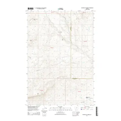
2014 Map of Hunters Hot Springs
USGS Topo · Published 2014About this map
Hunters Hot Springs serves as the focal point for this section of Montana where Park and Sweet Grass counties meet. The landscape is defined by its dramatic geologic naming conventions and transition from high peaks to drainage basins. To the northwest, the evocative Choke-To-Death Butte stands near Antelope Butte, overlooking a network of seasonal and perennial waterways like Hole-In-The-Rock Cr. The presence of Old Stage Rd and Convict Grade Rd in the southern portion of the map suggests historical transportation corridors that followed the natural contours of the land long before modern highway systems. High elevation landmarks such as Sheep Mtn and Long Ridge provide significant orientation points for the sparsely settled territory surrounding the Hole-In-The-Rock area, while Hunters Cr drains toward the thermal features that give the region its name.
Find a feature on this map
28 named features on this map. Tap any name to fly to it.
Don’t see what you’re looking for? This feature index may not catch every label — zoom into the map to look around manually.
Map Details
Editions of this 2014 Hunters Hot Springs Map
This is the sole edition of this map. No revisions or reprints were ever made.
Other maps of this area

1891 · Livingston
USGS Topo · 1:250,000

1893 · Livingston
USGS Topo · 1:250,000

1947 · Bozeman
USGS Topo · 1:250,000

1948 · Bozeman
USGS Topo · 1:250,000

1951 · Ibex Mountain
USGS Topo · 1:24,000

1951 · Grannis
USGS Topo · 1:24,000
1951 · Raspberry Butte
USGS Topo · 1:24,000

1951 · Kelly Hills
USGS Topo · 1:24,000

1951 · Springdale
USGS Topo · 1:24,000

1951 · Hunters Hot Springs
USGS Topo · 1:24,000