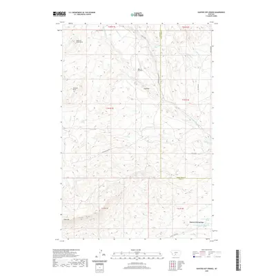
2020 Map of Hunters Hot Springs
USGS Topo · Published 2020About this map
Hunters Hot Springs sits at the southern edge of this Montana landscape, where the waters of Hunters Cr flow toward the Yellowstone River valley. The terrain is defined by dramatic elevations and unique local nomenclature, including the foreboding Choke-To-Death Butte in the northwest and the distinctive Hole-In-The-Rock formation. The map documents a complex drainage system across the Park County and Sweet Grass County line, featuring the W Fork Duck Cr, Lowell Cr, and Adair Cr.
Find a feature on this map
37 named features on this map. Tap any name to fly to it.
Don’t see what you’re looking for? This feature index may not catch every label — zoom into the map to look around manually.
Map Details
Editions of this 2020 Hunters Hot Springs Map
This is the sole edition of this map. No revisions or reprints were ever made.
Other maps of this area

1891 · Livingston
USGS Topo · 1:250,000

1893 · Livingston
USGS Topo · 1:250,000

1947 · Bozeman
USGS Topo · 1:250,000

1948 · Bozeman
USGS Topo · 1:250,000

1951 · Ibex Mountain
USGS Topo · 1:24,000

1951 · Grannis
USGS Topo · 1:24,000
1951 · Raspberry Butte
USGS Topo · 1:24,000

1951 · Kelly Hills
USGS Topo · 1:24,000

1951 · Springdale
USGS Topo · 1:24,000

1951 · Hunters Hot Springs
USGS Topo · 1:24,000