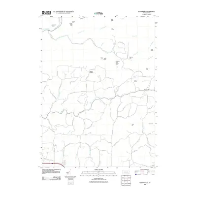
2010 Map of Huntersville
USGS Topo · Published 2010About this map
Huntersville and the surrounding drainage of Mill Creek anchor this landscape in Lycoming County, defined by a complex network of ridges and narrow valleys. To the north, the terrain rises sharply toward Allegheny Ridge and Tarkiln Ridge, where high points like Smiths Knob Vista and the Long Ridge Lookout Tower provide vantage points over the heavily wooded northern reaches. The settlement pattern is concentrated along winding country roads such as Kehrer Hill Rd and Quaker State Rd, with small clusters at Dewey Corner and Camp Conley. Along the southern margin, the influence of modern regional infrastructure is evident as the rural landscape transitions near Lycoming Mall Rd. Genealogists will find particular value in the documentation of the Huntersville Trinity Cemetery and the numerous family-named landmarks and hollows that reflect generations of local land use and ownership.
Find a feature on this map
89 named features on this map. Tap any name to fly to it.
Don’t see what you’re looking for? This feature index may not catch every label — zoom into the map to look around manually.
Map Details
Editions of this 2010 Huntersville Map
This is the sole edition of this map. No revisions or reprints were ever made.
Other maps of this area

1924 · Milton
USGS Topo · 1:62,500

1927 · Eagles Mere
USGS Topo · 1:48,000

1930 · Warrensville
USGS Topo · 1:62,500

1932 · Eagle Mere
USGS Topo · 1:62,500

1934 · Warrensville
USGS Topo · 1:62,500

1935 · Hughesville
USGS Topo · 1:62,500

1953 · Hughesville
USGS Topo · 1:62,500

1953 · Warrensville
USGS Topo · 1:62,500

1953 · Eagles Mere
USGS Topo · 1:62,500

1953 · Milton
USGS Topo · 1:62,500
Featured Places
- Muncy Township, PA
- Upper Fairfield Township, PA
- Fairfield Township, PA
- Plunketts Creek Township, PA
- Gamble Township, PA