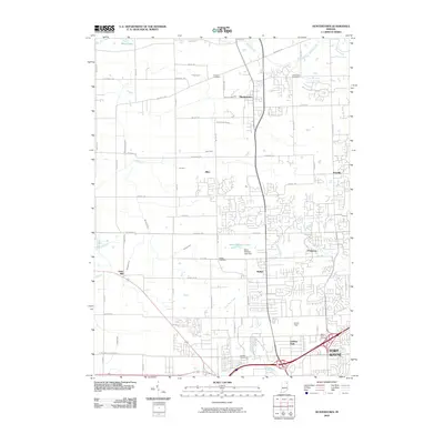
2010 Map of Huntertown
USGS Topo · Published 2010About this map
Huntertown and the surrounding northern reaches of Allen County are shown here in the early 21st century, transitioning from a landscape of rural drainage ditches to organized suburban expansion. The historical footprint of the area is anchored by several established burial grounds, including Fairview Cemetery and Huntertown Cemetery in the north, and Saint Pauls Cemetery further south near the city's edge. A complex network of managed waterways like Willow Creek Ditch and Hatch Ditch reflects the region's agricultural engineering, while the southern portion of the map is defined by the growing infrastructure of Fort Wayne. Aviation and industry are represented by Smith Field and local landmarks such as the Daus Addition Lake Dam. These developments sit alongside older named points such as Dunn Mill and the settlement of Wallen, illustrating the layering of modern residential growth over a previously agrarian grid.
Find a feature on this map
61 named features on this map. Tap any name to fly to it.
Don’t see what you’re looking for? This feature index may not catch every label — zoom into the map to look around manually.
Map Details
Editions of this 2010 Huntertown Map
This is the sole edition of this map. No revisions or reprints were ever made.
Other maps of this area

1953 · Fort Wayne
USGS Topo · 1:250,000

1955 · Ege
USGS Topo · 1:24,000

1956 · Fort Wayne
USGS Topo · 1:250,000

1956 · Fort Wayne West
USGS Topo · 1:24,000

1956 · Fort Wayne East
USGS Topo · 1:24,000

1956 · Cedarville
USGS Topo · 1:24,000

1957 · Auburn
USGS Topo · 1:24,000

1957 · Huntertown
USGS Topo · 1:24,000

1957 · Garrett
USGS Topo · 1:24,000

1957 · Churubusco
USGS Topo · 1:24,000