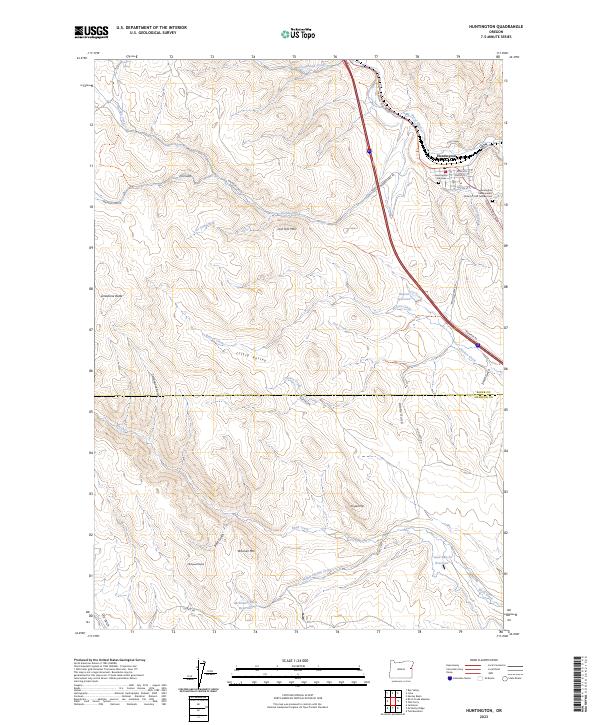
2023 Map of Huntington
USGS Topo · Published 2023About this map
The town of Huntington sits along the southern edge of the Burnt River valley, serving as a critical point of crossing in the high desert of Eastern Oregon. This 2023 survey details the town's grid, including its Post Office and the distinct Huntington Old Cem and Huntington Independent Order of Odd Fellows Cem. The landscape is dominated by the ridges and drainages of the Little Valley, marked by prominent landmarks such as Lost Tom Mtn and Striped Mtn. The transport network follows the historic corridor of the Oregon Trail Blvd and the Snake River Rd, reflecting the area's long-standing role as a gateway between basins. Water management in this arid environment is evident through features like Benson Reservoir and McDowell Butte Reservoir, while the Baker Co Malheur Co boundary line divides the southern reaches of the quadrangle.
Find a feature on this map
46 named features on this map. Tap any name to fly to it.
Don’t see what you’re looking for? This feature index may not catch every label — zoom into the map to look around manually.
Map Details
Editions of this 2023 Huntington Map
This is the sole edition of this map. No revisions or reprints were ever made.
Other maps of this area

1950 · Jamieson
USGS Topo · 1:62,500

1951 · Moores Hollow
USGS Topo · 1:62,500

1951 · Huntington
USGS Topo · 1:62,500

1952 · Olds Ferry NW
USGS Topo · 1:24,000

1952 · Olds Ferry
USGS Topo · 1:24,000

1952 · Olds Ferry
USGS Topo · 1:62,500

1955 · Baker
USGS Topo · 1:250,000

1959 · Baker
USGS Topo · 1:250,000

1980 · Brogan
USGS Topo · 1:100,000
1988 · Birch Creek Meadow
USGS Topo · 1:24,000