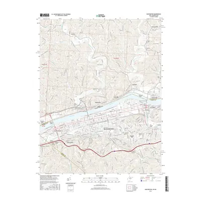
2016 Map of Huntington
USGS Topo · Published 2016About this map
The Ohio River flows past the industrial and residential heart of Huntington, serving as a natural border between West Virginia and Ohio. This 2016 survey illustrates the city’s complex infrastructure, where the Guyandotte River meets the Ohio near Guyandot Shoals. The landscape is marked by a dense concentration of historical burial grounds and memorial spaces, including the expansive Spring Hill Cem and the Confederate Cem near Beverly Hills. Transport routes define the valley, from the Huntington Floodwall Trail to the bridges connecting Chesapeake and Proctorville with the West Virginia shore. To the south, the terrain transitions into the steeper valleys of Gimlet Hollow, while the Nickel Plate Rd corridor reflects the area's deep-rooted connection to the rail economy. Smaller settlements like Getaway and Harveytown provide a view of the residential patterns that have formed around the region’s winding creeks and ridges.
Find a feature on this map
130 named features on this map. Tap any name to fly to it.
Don’t see what you’re looking for? This feature index may not catch every label — zoom into the map to look around manually.
Map Details
Editions of this 2016 Huntington Map
This is the sole edition of this map. No revisions or reprints were ever made.
Other maps of this area

1892 · Huntington
USGS Topo · 1:125,000

1898 · Huntington
USGS Topo · 1:125,000

1898 · Ironton
USGS Topo · 1:62,500

1900 · Ironton
USGS Topo · 1:62,500

1901 · Guyandot
USGS Topo · 1:62,500

1901 · Ceredo
USGS Topo · 1:62,500

1902 · Guyandot
USGS Topo · 1:62,500

1903 · Kenova
USGS Topo · 1:125,000

1904 · Kenova
USGS Topo · 1:125,000

1906 · Athalia
USGS Topo · 1:62,500