2023 Map of Huntington
USGS Topo · Published 2023About this map
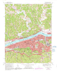
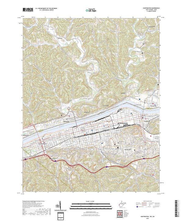
The Ohio River flows through the center of this map, separating the urban development of Huntington and Guyandotte from the agricultural and residential communities of southern Ohio. This 2023 survey illustrates the dense city grid of West Huntington protected by the Huntington Floodwall alongside prominent institutional campuses like Marshall University and the Cabell County Courthouse. The southern portion of the sheet reveals a rugged transition into the hills, where residential neighborhoods like Beverly Hills and Harveytown give way to larger parks such as Ritter Park and Rotary Park.
Find a feature on this map
62 named features on this map. Tap any name to fly to it.
Don’t see what you’re looking for? This feature index may not catch every label — zoom into the map to look around manually.
Map Details
Editions of this 2023 Huntington Map
This is the sole edition of this map. No revisions or reprints were ever made.
Historical Maps of Windsor Township Through Time
9 maps found