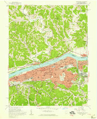
1957 Map of Huntington
USGS Topo · Published 1959About this map
The Ohio River valley at the confluence of the Guyandotte River shows a dense urban and industrial network in the late 1950s. Huntington is the anchor of this landscape, its grid extending from West Huntington through the historic Guyandotte neighborhood. The presence of Marshall College and multiple hospitals, including Huntington State Hospital, signals the city's role as a regional hub for education and healthcare.
Find a feature on this map
95 named features on this map. Tap any name to fly to it.
Don’t see what you’re looking for? This feature index may not catch every label — zoom into the map to look around manually.
Map Details
Editions of this 1957 Huntington Map
This is the sole edition of this map. No revisions or reprints were ever made.
Other maps of this area

1892 · Huntington
USGS Topo · 1:125,000

1898 · Huntington
USGS Topo · 1:125,000

1898 · Ironton
USGS Topo · 1:62,500

1900 · Ironton
USGS Topo · 1:62,500

1901 · Guyandot
USGS Topo · 1:62,500

1901 · Ceredo
USGS Topo · 1:62,500

1902 · Guyandot
USGS Topo · 1:62,500

1903 · Kenova
USGS Topo · 1:125,000

1904 · Kenova
USGS Topo · 1:125,000

1906 · Athalia
USGS Topo · 1:62,500