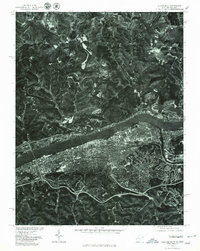
1976 Map of Huntington
USGS Topo · Published 1979About this map
The Ohio River serves as the central artery of this 1976 orthophotoquad, dividing the dense urban grid of Huntington and Harveytown in West Virginia from the rural hills of Ohio. This aerial perspective, captured by the Geological Survey in cooperation with the Soil Conservation Service, reveals the stark contrast between the industrialized riverbank and the winding creek valleys to the north. Smaller settlements like Chesapeake and Proctorville cling to the northern shore, while the interior of Lawrence County is defined by the drainages of Symmes Creek and Indian Guyan Creek. In the southeast, the confluence of the Guyandotte River marks a major geographical junction, highlighting the importance of river-based commerce and transportation for this tri-state region during the mid-1970s.
Find a feature on this map
9 named features on this map. Tap any name to fly to it.
Don’t see what you’re looking for? This feature index may not catch every label — zoom into the map to look around manually.
Map Details
Editions of this 1976 Huntington Map
This is the sole edition of this map. No revisions or reprints were ever made.
Other maps of this area

1892 · Huntington
USGS Topo · 1:125,000

1898 · Huntington
USGS Topo · 1:125,000

1898 · Ironton
USGS Topo · 1:62,500

1900 · Ironton
USGS Topo · 1:62,500

1901 · Guyandot
USGS Topo · 1:62,500

1901 · Ceredo
USGS Topo · 1:62,500

1902 · Guyandot
USGS Topo · 1:62,500

1903 · Kenova
USGS Topo · 1:125,000

1904 · Kenova
USGS Topo · 1:125,000

1906 · Athalia
USGS Topo · 1:62,500