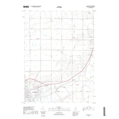
2019 Map of Huntington
USGS Topo · Published 2019About this map
Huntington serves as the primary hub in this Huntington County landscape, where the Little River and its various tributaries define the local geography. The map documents the intricate network of drainage ditches such as McPherren Ditch and Fahl Ditch that support the agricultural productivity of the region. This 2019 survey illustrates the expansion of modern residential streets alongside established rural settlements like Roanoke, Mardenis, and Bowerstown. Local history is anchored by sites like Union Cem and France Cem, while recreational and natural features such as Timber Lake and Clair Lake break the grid of section lines. The proximity of the Kilsoquah Farm Airport in the north and the cluster of activity around Mahon reflect a community shaped by both traditional land use and evolving transportation corridors.
Find a feature on this map
100 named features on this map. Tap any name to fly to it.
Don’t see what you’re looking for? This feature index may not catch every label — zoom into the map to look around manually.
Map Details
Editions of this 2019 Huntington Map
This is the sole edition of this map. No revisions or reprints were ever made.
Other maps of this area

1950 · Andrews
USGS Topo · 1:24,000

1951 · Andrews
USGS Topo · 1:24,000

1952 · Majenica
USGS Topo · 1:24,000

1953 · Fort Wayne
USGS Topo · 1:250,000

1953 · Muncie
USGS Topo · 1:250,000

1955 · Markle
USGS Topo · 1:24,000

1955 · Bippus
USGS Topo · 1:24,000

1956 · Muncie
USGS Topo · 1:250,000

1956 · Fort Wayne
USGS Topo · 1:250,000

1956 · Huntington
USGS Topo · 1:24,000