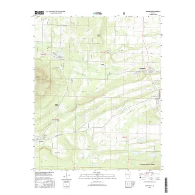
2017 Map of Huntington
USGS Topo · Published 2017About this map
Huntington and the surrounding coal-country settlements of southern Sebastian County are surveyed here in 2017. The landscape is defined by the prominent Devils Backbone Ridge and the heights of Midland Peak and the Sugar Loaf Mountains. Between these ridges, the map shows a network of small, established towns like Midland, Hartford, and the smaller community of Frog Town. The map provides significant detail for genealogists, documenting numerous local burial grounds including James Fork Cem, Dake Cem, and the Hartford Memorial Cem. Water resources are central to the terrain, with James Fork and its tributaries such as Cherokee Cr and Prairie Creek winding through the valley. To the south, the boundary of the Ouachita National Forest marks a transition from the residential and agricultural grid into protected timberland.
Find a feature on this map
107 named features on this map. Tap any name to fly to it.
Don’t see what you’re looking for? This feature index may not catch every label — zoom into the map to look around manually.
Map Details
Editions of this 2017 Huntington Map
This is the sole edition of this map. No revisions or reprints were ever made.
Other maps of this area

1879 · Poteau Mountain
USGS Topo · 1:62,500

1887 · Poteau Mountain #1
USGS Topo · 1:62,500

1887 · Poteau Mountain #2
USGS Topo · 1:62,500

1887 · Greenwood
USGS Topo · 1:62,500

1890 · Fort Smith
USGS Topo · 1:125,000

1890 · Poteau Mountain
USGS Topo · 1:125,000

1899 · Poteau Mountain
USGS Topo · 1:125,000

1906 · Barber
USGS Topo · 1:62,500

1939 · Waldron
USGS Topo · 1:62,500

1940 · Waldron
USGS Topo · 1:62,500