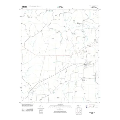
2010 Map of Huntland
USGS Topo · Published 2010About this map
Huntland and its surrounding rural communities are depicted at a time of steady agricultural and residential continuity in Franklin County. The landscape is defined by the drainage of Beans Creek and Robinson Creek, which carve through numerous family-named hollows like Arnold Hollow and Sulphur Hollow. Local history is deeply etched into the terrain through a high concentration of small family and community burial grounds, including the Moseley-Simmons Cemetery and Eskridge Cemetery, which provide critical reference points for genealogical research.
Find a feature on this map
115 named features on this map. Tap any name to fly to it.
Don’t see what you’re looking for? This feature index may not catch every label — zoom into the map to look around manually.
Map Details
Editions of this 2010 Huntland Map
This is the sole edition of this map. No revisions or reprints were ever made.
Other maps of this area

1888 · Scottsboro
USGS Topo · 1:125,000

1892 · Scottsboro
USGS Topo · 1:125,000

1928 · Decherd
USGS Topo · 1:62,500

1936 · King Cove
USGS Topo · 1:24,000

1936 · Flintville
USGS Topo · 1:24,000

1936 · Beans Creek
USGS Topo · 1:24,000

1936 · Huntland
USGS Topo · 1:24,000

1936 · Belvidere
USGS Topo · 1:24,000
1936 · New Market
USGS Topo · 1:24,000

1936 · Mulberry
USGS Topo · 1:24,000