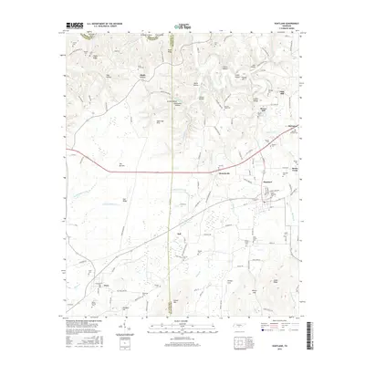
2016 Map of Huntland
USGS Topo · Published 2016About this map
Huntland serves as a central hub in this Southern Tennessee landscape where Lincoln Co and Franklin Co meet. The area is defined by a dense network of family-named cemeteries and landmarks, reflecting generations of rural settlement near Old Salem and Branchville. To the northeast, Falls Mill and Brown Mill stand as markers of early local industry along the waterways, while the terrain transitions from the low-lying reaches of The Barrens to the prominent rise of Stovall Mtn in the south. The layout of the land is heavily influenced by the drainage of Beans Creek and its many tributaries, such as Indian Cr and Robinson Cr, which carve through hollows like Keith Hollow and Sulphur Hollow. Local history is deeply embedded in the map's labels, from the Moore Memorial Cem in town to the numerous smaller burial grounds like Moseley-Simmons Cem and Damron Cem scattered across the countryside.
Find a feature on this map
142 named features on this map. Tap any name to fly to it.
Don’t see what you’re looking for? This feature index may not catch every label — zoom into the map to look around manually.
Map Details
Editions of this 2016 Huntland Map
This is the sole edition of this map. No revisions or reprints were ever made.
Other maps of this area

1888 · Scottsboro
USGS Topo · 1:125,000

1892 · Scottsboro
USGS Topo · 1:125,000

1928 · Decherd
USGS Topo · 1:62,500

1936 · King Cove
USGS Topo · 1:24,000

1936 · Flintville
USGS Topo · 1:24,000

1936 · Beans Creek
USGS Topo · 1:24,000

1936 · Huntland
USGS Topo · 1:24,000

1936 · Belvidere
USGS Topo · 1:24,000
1936 · New Market
USGS Topo · 1:24,000

1936 · Mulberry
USGS Topo · 1:24,000