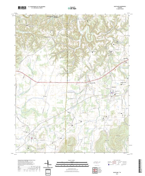
2022 Map of Huntland
USGS Topo · Published 2022About this map
Falls Mill and Brown Mill define the industrial heritage of this region where Lincoln, Franklin, and Moore Counties meet. The landscape is deeply carved by the Elk River and its tributaries, including Indian Cr and Beans Creek, creating a series of hollows and ridges such as Keith Hollow and Skeet Ridge. The town of Huntland serves as a central hub, surrounded by smaller historical settlements like Elora, Branchville, and Old Salem.
Find a feature on this map
155 named features on this map. Tap any name to fly to it.
Don’t see what you’re looking for? This feature index may not catch every label — zoom into the map to look around manually.
Map Details
Editions of this 2022 Huntland Map
This is the sole edition of this map. No revisions or reprints were ever made.
Other maps of this area

1888 · Scottsboro
USGS Topo · 1:125,000

1892 · Scottsboro
USGS Topo · 1:125,000

1928 · Decherd
USGS Topo · 1:62,500

1936 · King Cove
USGS Topo · 1:24,000

1936 · Flintville
USGS Topo · 1:24,000

1936 · Beans Creek
USGS Topo · 1:24,000

1936 · Huntland
USGS Topo · 1:24,000

1936 · Belvidere
USGS Topo · 1:24,000
1936 · New Market
USGS Topo · 1:24,000

1936 · Mulberry
USGS Topo · 1:24,000