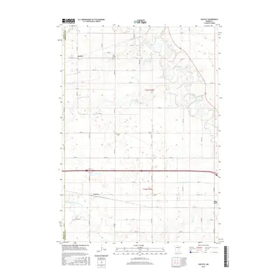
2016 Map of Huntley
USGS Topo · Published 2016About this map
Huntley and Guckeen anchor this agricultural landscape in Faribault County, where the transition from natural waterways to engineered drainage is clearly visible. The meandering course of the Blue Earth River and its tributaries, including Center Cr, South Cr, and Badger Cr, cut through the section lines of the township grid. These natural streams are supplemented by large-scale water management projects like Judicial Ditch Number Four and County Ditch Number Sixty, reflecting the area's intensive land use for farming.
Find a feature on this map
32 named features on this map. Tap any name to fly to it.
Don’t see what you’re looking for? This feature index may not catch every label — zoom into the map to look around manually.
Map Details
Editions of this 2016 Huntley Map
This is the sole edition of this map. No revisions or reprints were ever made.
Other maps of this area

1954 · Fairmont
USGS Topo · 1:250,000

1958 · Fairmont
USGS Topo · 1:250,000

1967 · Pilot Grove
USGS Topo · 1:24,000

1967 · East Chain
USGS Topo · 1:24,000

1967 · Truman SE
USGS Topo · 1:24,000

1967 · Winnebago
USGS Topo · 1:24,000

1967 · Elmore
USGS Topo · 1:24,000

1967 · Granada
USGS Topo · 1:24,000

1967 · Huntley
USGS Topo · 1:24,000
1967 · Delavan
USGS Topo · 1:24,000