
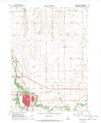
1967 Map of Winnebago
USGS Topo · Published 1968About this map
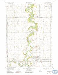
The Blue Earth River carves a winding path through the center of this Faribault County landscape, serving as the primary geographical anchor for the city of Winnebago. During the late 1960s, this area functioned as a vital transportation hub where the Chicago and North Western and the Chicago Milwaukee St Paul and Pacific railroads intersected. The surrounding agricultural townships, including Verona, Shelby, and Winnebago City, are characterized by a sophisticated drainage network of judicial ditches, such as Judicial Ditch No 24 and Judicial Ditch No 11, which transformed the prairie for farming. Genealogists will find significant value in the documentation of several burial sites, including Rose Hill Cem, St Marys Cem, and Riverside Cem, while the northern portion of the map shows the transition of the Jackson Lakebed into manageable terrain.
Find a feature on this map
32 named features on this map. Tap any name to fly to it.
Don’t see what you’re looking for? This feature index may not catch every label — zoom into the map to look around manually.
Map Details
Editions of this 1967 Winnebago Map
2 editions found
Other maps of this area

1954 · Fairmont
USGS Topo · 1:250,000

1958 · Fairmont
USGS Topo · 1:250,000

1967 · Truman SE
USGS Topo · 1:24,000

1967 · Willow Creek
USGS Topo · 1:24,000

1967 · Granada
USGS Topo · 1:24,000

1967 · Huntley
USGS Topo · 1:24,000
1967 · Amboy
USGS Topo · 1:24,000
1967 · Delavan
USGS Topo · 1:24,000
1967 · Sterling Center
USGS Topo · 1:24,000
1967 · Blue Earth
USGS Topo · 1:24,000