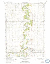
1967 Map of Winnebago
USGS Topo · Published 1991About this map
Winnebago serves as the central hub of this agricultural landscape in Faribault County, where the Blue Earth River and Elm Creek converge. The settlement pattern is defined by its strategic position at the crossing of major rail lines, including the Chicago and North Western and the Chicago Milwaukee St Paul and Pacific railroads. The map reveals a community deeply rooted in its local history, evidenced by a high density of rural burial grounds such as Rose Hill Cem, Riverside Cem, and St Marys Cem. North of town, the terrain rises toward Pleasant Mound, while the surrounding prairie is heavily engineered for drainage via systems like Judicial Ditch No 11. Local landmarks like the Radio Tower and Basey Ch stand out against the geometric grid of 1960s Midwestern farmsteads and gravel operations.
Find a feature on this map
32 named features on this map. Tap any name to fly to it.
Don’t see what you’re looking for? This feature index may not catch every label — zoom into the map to look around manually.
Map Details
Editions of this 1967 Winnebago Map
2 editions found
Other maps of this area

1954 · Fairmont
USGS Topo · 1:250,000

1958 · Fairmont
USGS Topo · 1:250,000

1967 · Truman SE
USGS Topo · 1:24,000

1967 · Winnebago
USGS Topo · 1:24,000

1967 · Willow Creek
USGS Topo · 1:24,000

1967 · Granada
USGS Topo · 1:24,000

1967 · Huntley
USGS Topo · 1:24,000
1967 · Amboy
USGS Topo · 1:24,000
1967 · Delavan
USGS Topo · 1:24,000
1967 · Sterling Center
USGS Topo · 1:24,000