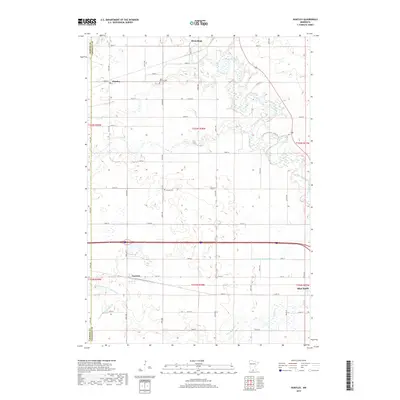
2019 Map of Huntley
USGS Topo · Published 2019About this map
Winnebago and Blue Earth anchor this agricultural landscape in Faribault County, where the southern Minnesota prairie is defined by an intricate network of natural waterways and engineered drainage. The winding path of the Blue Earth River and its tributaries, such as Center Cr and Badger Cr, cut through the geometric grid of township roads. The map captures the small settlements of Huntley and Guckeen, along with quiet landmarks like West Verona Cem and Verona Cem, which provide valuable touchpoints for family historians. The prevalence of features such as Judicial Ditch Number Four and County Ditch Number Sixty illustrates the intensive water management required to sustain the region's productive farmland. This detailed survey preserves the spatial relationship between these rural communities and the shifting watercourses that have shaped the local economy and settlement patterns for generations.
Find a feature on this map
37 named features on this map. Tap any name to fly to it.
Don’t see what you’re looking for? This feature index may not catch every label — zoom into the map to look around manually.
Map Details
Editions of this 2019 Huntley Map
This is the sole edition of this map. No revisions or reprints were ever made.
Other maps of this area

1954 · Fairmont
USGS Topo · 1:250,000

1958 · Fairmont
USGS Topo · 1:250,000

1967 · Pilot Grove
USGS Topo · 1:24,000

1967 · East Chain
USGS Topo · 1:24,000

1967 · Truman SE
USGS Topo · 1:24,000

1967 · Winnebago
USGS Topo · 1:24,000

1967 · Elmore
USGS Topo · 1:24,000

1967 · Granada
USGS Topo · 1:24,000

1967 · Huntley
USGS Topo · 1:24,000
1967 · Delavan
USGS Topo · 1:24,000