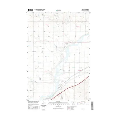
2017 Map of Huntley
USGS Topo · Published 2017About this map
Huntley and Shepherd anchor this 2017 survey of the Yellowstone Valley, where the Yellowstone River snakes through a complex landscape of islands, canals, and coulees. The agricultural footprint is defined by the Huntley Main Canal, a significant piece of irrigation engineering that runs parallel to the river. Researchers will find the Railroad Hwy following the southern corridor near the town of Huntley, while the northern landscape around Shepherd transitions into higher terrain marked by Deer Point. Local history is preserved at the Huntley Cemetery and Scandia Cemetery, sites that mark the generational settlement of these ranching and farming communities. The map also detail numerous smaller watercourses like Pryor Creek and Custer Coulee, alongside named features such as Spraklin Island, providing a clear view of how water management has shaped the modern Montana landscape.
Find a feature on this map
93 named features on this map. Tap any name to fly to it.
Don’t see what you’re looking for? This feature index may not catch every label — zoom into the map to look around manually.
Map Details
Editions of this 2017 Huntley Map
This is the sole edition of this map. No revisions or reprints were ever made.
Other maps of this area

1893 · Huntley
USGS Topo · 1:125,000

1954 · Billings
USGS Topo · 1:250,000

1954 · Roundup
USGS Topo · 1:250,000

1956 · Rattlesnake Butte
USGS Topo · 1:24,000

1956 · Huntley
USGS Topo · 1:24,000

1956 · Billings East
USGS Topo · 1:24,000

1957 · Billings
USGS Topo · 1:250,000

1958 · Billings
USGS Topo · 1:250,000

1958 · Roundup
USGS Topo · 1:250,000

1967 · Worden
USGS Topo · 1:24,000