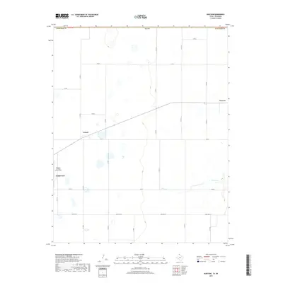
2019 Map of Huntoon
USGS Topo · Published 2019About this map
Perryton anchors the southwestern edge of this High Plains landscape, where the flat agricultural terrain of the Texas Panhandle is defined by a rigid grid of section roads. The map illustrates a region transitioning from the suburban outskirts of the county seat toward the small settlements of Twichell and Huntoon to the northeast. These communities are linked by the primary highway and rail corridor that cuts diagonally across the otherwise rectilinear survey lines, highlighting the importance of transportation to these grain-producing locales. Near the southern boundary, the relief becomes more pronounced along the banks of Kiowa Cr, where the headwaters have carved subtle drainages into the plateau. This 2019 survey also shows the Perryton Ochiltree County Airport, a critical infrastructure point for this remote corner of Ochiltree County.
Find a feature on this map
21 named features on this map. Tap any name to fly to it.
Don’t see what you’re looking for? This feature index may not catch every label — zoom into the map to look around manually.
Map Details
Editions of this 2019 Huntoon Map
This is the sole edition of this map. No revisions or reprints were ever made.
Other maps of this area

1954 · Perryton
USGS Topo · 1:250,000

1958 · Perryton
USGS Topo · 1:250,000

1972 · Booker SE
USGS Topo · 1:24,000

1973 · Booker
USGS Topo · 1:24,000

1973 · Booker SW
USGS Topo · 1:24,000

1973 · Perryton SE
USGS Topo · 1:24,000

1973 · Perryton
USGS Topo · 1:24,000

1973 · Elmwood
USGS Topo · 1:24,000

1973 · Bryans Corner
USGS Topo · 1:24,000

1973 · Balko SW
USGS Topo · 1:24,000