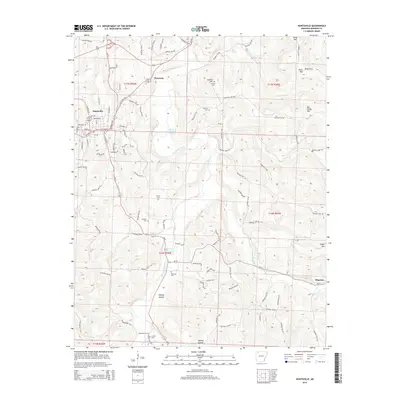
2014 Map of Huntsville
USGS Topo · Published 2014About this map
Huntsville serves as the primary hub of this Madison County landscape, where the street grid of the town center transitions into a network of country roads following the contours of the Ozark foothills. The drainage of War Eagle Creek and its many tributaries, including Wharton Cr and Town Br, dictates the placement of early settlements and agricultural clearings. The map reveals a deeply rooted community structure, evidenced by numerous family-named landmarks and burial grounds such as Carlock Cem, Reeves Cem, and McBroom Cem. Beyond the main town, smaller outposts like Harmony, Wharton, and Aurora are positioned along the primary transit corridors of Us-412 and Ar-23. High points such as Carlock Mtn and Diera Mtn punctuate the horizon, overlooking the winding paths of Hanney Hollow and Rays Cove.
Find a feature on this map
104 named features on this map. Tap any name to fly to it.
Don’t see what you’re looking for? This feature index may not catch every label — zoom into the map to look around manually.
Map Details
Editions of this 2014 Huntsville Map
This is the sole edition of this map. No revisions or reprints were ever made.
Other maps of this area

1900 · Eureka Springs
USGS Topo · 1:125,000

1901 · Eureka Springs
USGS Topo · 1:125,000

1943 · St. Paul
USGS Topo · 1:62,500

1945 · Harrison
USGS Topo · 1:250,000

1946 · St. Paul
USGS Topo · 1:62,500

1949 · Harrison
USGS Topo · 1:250,000

1954 · Harrison
USGS Topo · 1:250,000

1956 · Russellville
USGS Topo · 1:250,000

1958 · Hindsville
USGS Topo · 1:24,000

1958 · Harrison
USGS Topo · 1:250,000