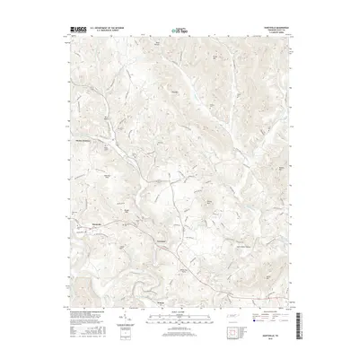
2016 Map of Huntsville
USGS Topo · Published 2016About this map
Huntsville serves as the central hub of this Tennessee landscape, where the New River and its numerous tributaries like Paint Rock Cr carve through a network of ridges and hollows. The map reveals a high density of family-named landmarks and cemeteries, reflecting a deeply rooted local genealogy in settlements such as Newtown, Winona, and Stanley Junction. The distribution of burial sites, including Buttram Cem, Strunk Cem, and the uniquely named Punkin Hollow Cem, suggests scattered homesteads and community clusters that follow the winding paths of roads like Buffalo Rd and Laxton Cemetery Rd. Terrain features such as Ditney Mtn and Shug Mtn dominate the topography, while the New River corridor provides a natural artery through the southern portion of the quadrangle.
Find a feature on this map
113 named features on this map. Tap any name to fly to it.
Don’t see what you’re looking for? This feature index may not catch every label — zoom into the map to look around manually.
Map Details
Editions of this 2016 Huntsville Map
This is the sole edition of this map. No revisions or reprints were ever made.
Other maps of this area

1890 · Williamsburg
USGS Topo · 1:125,000

1893 · Briceville
USGS Topo · 1:125,000

1894 · Williamsburg
USGS Topo · 1:125,000

1895 · Wartburg
USGS Topo · 1:125,000

1895 · Briceville
USGS Topo · 1:125,000

1896 · Wartburg
USGS Topo · 1:125,000

1896 · Briceville
USGS Topo · 1:125,000

1934 · Barthell
USGS Topo · 1:62,500

1936 · Block
USGS Topo · 1:24,000

1936 · Pioneer
USGS Topo · 1:24,000